The rain I'd experienced the day before stopped overnight, but the shelter remained wrapped in a cool, heavy mist as morning crept in. I'd set my alarm for 6 AM, but overslept and found myself stowing my gear well after 7 AM.
 |
| Russell Field Shelter in the morning fog. | | | |
|
|
|
With only 13.5 miles to go, and most of it downhill to Fontana Dam, I was anxious to get an early start and skipped my usual hot morning coffee for some "trail cold-brew" to go. Just add two packets of instant coffee to a liter of water, shake it up, and start walking.For some miles the fog lay heavy, but blue skies gradually broke through and it turned into a sunny day.
 |
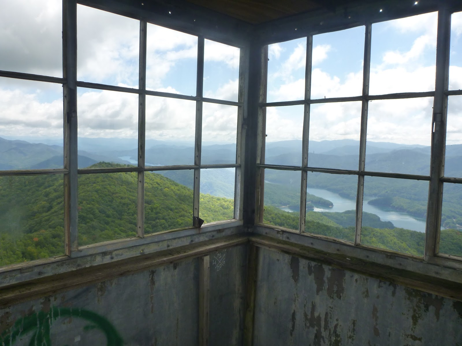
| Shuckstack fire tower |
I gradually began running into hikers starting their own GSMNP traverses. For whatever reason, more people seem to hike the Smokies starting at the south and working north. It may be because the climb out of Fontana is not as steep and rugged as the route I took to enter the park. And trail conditions in the southern half of the park were generally smoother as well. In each case, I had to pass along the bad news about the lack of water at the next few shelters. Most seem well prepared for this, but a few looked rather concerned as I passed along the info I'd gleaned while hiking south.
With about 4 miles to go, I took the short side trail (uphill, of course) to the Shuckstack fire tower. The tower supports only a small observation platform at the top, while the remains of the foundations of a firewarden's cabin are located below. The climb was a bit daunting, given my natural aversion to heights, but the view was excellent, and I could clearly see Fontana Lake and Fontana Dam, my ultimate destination.
 |
| It's an impressive view! |
After a quick lunch break, it was time for the final push homewards, and I found myself jogging along the trail as it went down the mountain - an interesting sensation with a 30-pound pack on your back.
 |
| Approaching Fontana Dam. |
It was with real satisfaction that I strode the final yards across the top of Fontana Dam. 12 days, 175 miles, an average of 14 miles a day. Not Karl Meltzer speed, for sure, but pretty solid hiking over some big mountains and rough terrain. And best of all, nearly everything had gone according to plan. Yet I had one final surprise awaiting me.
 |
| Dead battery... |
My trusty Subaru's battery was dead as a door nail. Fortunately the good people at the Fontana Dam Visitor's Center let me borrow their phone (no cell service at the dam), and I soon had AAA on the way. While waiting I talked to Samurai - the only true SOBO hiker I saw during the trip. Three months out from Maine, and with only 160 miles to go. Thin and ragged, but in good spirits.I offered a ride when my car got started, but he moved along before I was running again.
 |
| Samurai checks his trail guide |
Eventually, I was on the way, with a new battery, a hot shower, and clean clothes. It was a great trip, and I'm looking forward to the future, when I can come back south to knock off the last miles between Fontana and Springer Mountain.
 |
| My white knight pickup truck. |


 The oldest home in Hot Springs, circa 1840.


