Wednesday, August 09, 2017

Hiking the Whites 2017 - Hut Life

So far you've heard me mention "huts" quite a bit, so lets take a little time and talk about the Appalachian Mountain Club hut system and what staying at a hut is like.
Getting ready to leave the cozy confines of Galehead Hut on a blustery morning.
The hut system in the Whites can trace its roots back to the 1880s, when a rude stone building sleeping 12 was erected in the shadow of Mount Madison, the site of the current Madison Springs Hut. Over the years huts have expanded and been remodeled or rebuilt as necessary to accommodate more travelers and account for the wear and tear of mountain conditions.

Not your typical AT shelter

If you're familiar with the iconic open-sided shelters of the Appalachian Trail, throw out those preconceptions - the White Mountain huts are nothing like those. Every hut has some common attributes: a dining area for eating or relaxing,  a small library, several bunkrooms accommodating a dozen or more hikers, and indoor bathrooms with composting toilets and cold running water. Each hut is staffed by a "croo" of college students, who prepare and serve dinner and breakfast, and your bunk is outfitted with three wool blankets and a pillow.
Bunks at the Madison Spring Hut

Off the grid

Even the easiest huts to reach are several miles from the nearest trailhead, so you're truly living off-grid. Cooking fuel is propane, airlifted by helicopter at the start of each season, and power is supplied by either solar, wind, or hydro power. With the lowering costs of solar and lithium batteries, solar is the most common power source. Electricity is rationed tightly. With only one exception that I saw, there were no power outlets for charging devices, and lighting was generally restricted to the common areas of the hut. Bring your headlamp - I found that I needed mine during the day in some of the bunkrooms! As for supply, many of the staples are also airlifted in, but croo members continue the tradition of hauling loads of perishables via packboard on an almost daily basis. It's an impressive site to see!
A croo member hefts in a load. She's completing a 4 mile trip with 3500' of elevation gain.

Carmel models the latest packboard style.
A day in the life

When you reach the destination of your hut for the night, you're greeted by a croo member at the desk/camp store, where they check you off the reservation list and tell you which bunk room you're in. Then it's a mad scurry to get the bunk you want. Some like the lower levels, but I didn't mind being on the second or third levels. You spread our your sheet or sleeping bag liner, arrange your blankets and pillows, and hang up your gear on whatever hooks you can find (some huts have plenty, some not nearly enough - a real challenge when it's been a wet day).

The common area at Madison Spring Hut
 After staking your claim, it's time to hang out, read, socialize, have a cup of tea, or explore the area around the hut until the highlight of the evening - dinner! Served promptly at 6 PM, dinner is simple fare, filling, and almost universally good. Everything is served family-style, so you quickly get to know your hut mates as you ask for more bread, salt and pepper, second helpings, and pass around the food. A sample menu might include: creamy tomato soup with cornbread, green salad, pulled pork with rolls, mashed potatoes, plus brownies and coffee for desert.
Dinner time at Madison Spring Hut
Dinner is also when the croo introduces themselves. All college students, with a northeastern emphasis, many are doing their second or third summers - it's a highly prized summer job. Post dinner time consists of naturalist programs, more socializing, games, or more. After a day of hiking and a big meal, most hut guests are ready to turn in by the time it's lights out at 9:30.
Breakfast time is croo skit time - an opportunity to tell us to fold our blankets, pack out our trash, and leave a tip for the croo!
Morning wakeup call comes at 6:30. Usually the croo sings a song, but at Greenleaf Hut one croo member recited poetry. My favorite wakeup was at Galehead Hut, where the croo did a fine rendition of Gillian Welch's "Miss Ohio." A hearty breakfast follows at 7 AM, followed by the croo skit and the weather report. As the hikers depart, the croo tidies up and awaits the next bunch to come down the trail.
The weather forecast is a highlight of the morning. 
Cost/benefit

The hut system makes the peaks of the Whites accessible to a wide range of people. We saw a blend of seasoned hikers, day hikers, families, school groups, and guided groups. Some were out for a night or two, others had more ambitious itineraries, like our 7-day tip. That creates a lot of demand for the space available. In our case, I made reservations in January and still had to scramble to put together an itinerary that fit our schedule. And huts aren't free. An average night at a hut will cost about $100-$115 per person. Worth it, in my estimation, but quite different from the freedom associated with hiking on the Appalachian Trail nearly everywhere else.

The thruhiker conundrum 

That brings me to the final issue of the hut system. The huts provide a great service to many, and help preserve the sub-alpine and alpine ecosystems of the mountains by concentrating activity into specific locations. But to Appalachian Trail thru-hikers, the huts are a mixed blessing. Free shelters and campsites are generally located well off the trail in the Whites, and many thruhikers can't afford the cost of the huts, let alone predict their schedule far enough in advance to reserve space. The solution is "work for stay."
Two of three thruhikers who shared Galehead Hut with us. In exchange for leftovers and a spot on the floor, they assisted the croo with morning cleanup after their stay. 
Work for stay for AT hikers is an old tradition at the huts. Thrus who request work for stay will be assigned some task to perform, and are fed leftovers from the meals. Then they'll get a spot on the dining room floor to spend the night. Not a bad deal really, compared to a typical AT shelter. But as the number of prospective thruhikers has increased, the system is undoubtedly being strained. I saw as many as a dozen thruhikers crashed on the floor on some mornings, with more being turned away, particularly if they arrived early in the day.

Next time - Day Three, and Weather in the Whites

Sunday, August 06, 2017

Hiking the Whites Day 2 - From Greenleaf to Galehead (and the trials of Garfield Ridge)

At the end of the first day, we came down off of Franconia Ridge to our first hut stay at Greenleaf Hut. Greenleaf Hut is popular due to a convenient trailhead, so it was already packed with hikers for the weekend. We snagged our bunks and settled in for dinner.
Dinner with 40-50 of our close friends
The huts offer more than just meals and a bunk. Each evening after dinner, one of the "croo" will give a naturalists talk about some aspect of the local ecology. In our case, we attended a well-done talk about the history of logging in the Whites. The hut system is worth an entire post on its own, which you'll get shortly!
Our naturalist prepares for her talk
One nice thing about the huts is a strictly enforced "lights out" at 9:30. And in five nights at the huts I was never disturbed after nights out. If you don't count snoring, that is.

Our goal for Day Two was to hike back up to Mount Lafayette, then head north along the Garfield Ridge Trail to Galehead Hut. Aside from a rocky 1000 foot ascent at the beginning, the elevation profile looked pretty smooth. But we'd been warned the night before not to underestimate the challenges of this section of trail.

Sunrise over Mount Lafayette
While we stepped off under blue skies, by the time we reached the summit of Mount Lafayette, clouds had rolled in - a reminder of how quickly the weather can change in the mountains. Fortunately it cleared as we descended, and we enjoyed ideal weather for the rest of the day.
A view back towards Greenleaf Hut

Hiking in the clouds
I've hiked over a 1000 miles of the AT, and seen a lot of trail -- both good and bad. The trails of the Whites presented some of the toughest hiking I've ever encountered. The trails are well-maintained, but constantly throw challenges at you. Rocky footing is the norm, along with steep ups and downs, with a healthy dose of bouldering thrown in as well. Topographically the Garfield Ridge Trail didn't look like much, but it was a constant challenge. Hats off to the hardy New Englanders who get to enjoy these trails on a regular basis!
Carmel scoots down a section of steep rocks.

Yet another dicey section of trail.
The one significant bump on the topo map for the hike was Mount Garfield. After passing a lovely pond at the base, we inched up a steep climb to the summit. The 360-degree views were totally worth the effort, and the summit was a fine place to take a break.
Garfield Pond, a lovely sight at 3000+ feet of elevation

Carmel takes a break on Mount Garfield. That's Mount Lafayette in the background, with Garfield Ridge extending to the right. 

Looking south from Mount Garfield towards Franconia Ridge. The foundation is from an old firetower.
From Mount Garfield, we still had about 3 tough miles to go to Galehead Hut. The combination of tough terrain and climbing meant we got in after 6 PM - dinner time - but the very accommodating crew at the hut was happy to serve us late. 

Galehead Hut was quite a different experience from Greenleaf. It's more remote than Greenleaf, and smaller, with a more relaxed vibe than the somewhat frantic environment of Greenleaf. There was plenty of room to stretch out and relax after dinner, and even catch up with some north-bound AT hikers. With less than 400 miles to go, they were anxiously anticipating getting into Maine to finish their journey.
Traci and Carmel chat with NOBO thru-hikers. 
Next time - I'll talk about the hut experience, and then we get our first taste of bad weather.

Saturday, August 05, 2017

Hiking the Whites Day 1 - Up to Franconia Ridge

After enjoying breakfast, our AMC shuttle picked us up promptly at 9 AM. The drive to our trailhead at Lafayette Campground took us back several Forest Service roads to other trailheads, where we dropped off other hikers. Carmel saw a bear crossing a river, and Traci a moose grazing by the side of the road. Nothing for me...

Back on the main roads, we retraced our steps from yesterday through Franconia Notch. It was Saturday during the peak summer season, and it looked like a large chunk of the northeast had decided to go for a hike. Parking lots were full, and cars clogged the sides of the roads. A steady stream of day hikers accompanied us as we began our way up the long climb of the Falling Waters Trail to our destination - the bare heights of Franconia Ridge.
We begin the journey!
Falling Waters Trail didn't disappoint. For most of the way it paralleled a watercourse that descended off the ridge in a series of cataracts, several quite impressive. The trail is well-maintained, but also quite rocky and rough - a preview of coming attractions, it turned out.
One of the falls - see the hikers at the top for scale. 
After a long climb, and lots of foot traffic, we came out of the woods to the open spaces of Franconia Ridge. Stretching away to the north were the peaks of Mount Lincoln and Mount Lafayette, both topping out at over 5000 feet. We broke for lunch with the crowds (note - don't expect a solitary experience on Franconia Ridge on a Saturday), chatted with a Ridge Runner, and started north along the ridge.


Ravens are in abundance on the ridge. They've learned to pick up food scraps from hikers. 
David and I check in with a Ridge Runner. 
The trail along Franconia Ridge is relatively short, but extremely memorable. Looking to the northeast you can pick out the major peaks of the Presidential Range, while looking west and down you can pick out highway cutting through Franconia Notch, and reflect on what a climb you've made to arrive at the top. Mount Lincoln and Mount Lafayette ranged ahead of us, before the descent of 1000 feet to our destination for the night, Greenleaf Hut.
Carmel and Traci step out towards Mount Lincoln.
Much care has been taken to channel the trail into a narrow path along the top of the ridge, to avoid damage to the fragile plants in this alpine zone. Fortunately for us, the weather was beautiful. We'd yet to experience the variety of weather the Whites can throw at you.
Carmel ascends Mount Lincoln
The iconic view, looking north towards Mount Lafayette
Carmel and I bag a peak!
After a few tough miles we'd reached the summit of Mount Lafayette and took some time to take in the view, including Greenleaf Hut, 1000 feet below us on the shoulder of the mountain. It was time to head down for dinner and to grab some shut eye. Our mileage was only around six miles, but we'd put in some work to get there!
Carmel and Traci (foreground) descend towards Greenlear Hut (upper left).

Next Time - Greenleaf Hut to Galehead Hut

Friday, August 04, 2017

Hiking the Whites - On to the north!

Of course, we needed to get to New Hampshire before we could hike. After consulting with Traci and David, we settled on a plan. They'd fly into Newark late on Thursday, we'd pick them up on Friday morning, and we'd head north to begin the hike on Saturday. Accordingly, we made reservations at their hotel and drove the first leg on Thursday afternoon.

The vagaries of 21st century air travel soon threw a monkey wrench in our plans. After a late departure from Denver, our companions were stuck in Washington, with no way to get to Newark. A quick change in plans rerouted them to Boston, so we struck north in the morning and braved the congestion of the north east to pick them up. Eventually all worked out, and we succeeded in getting the four of us, and all of our gear, into the trusty Subaru.

David and Traci settle in for the ride north.
To reach the AMC Highland Center, our home base, we passed through Franconia Notch, the westernmost of the three "notches" that funnel traffic through the Whites. Franconia Notch travels past impressive mountains on both sides. To the right, we could see Mount Lincoln and Mount Lafayette, two of the peaks we'd hike over the next day. And on the left, impressive rock walls loomed up - very different from the Blue Ridge Mountains of Virginia.
Yup, got some pretty nice peaks in NH!
The Highland Center didn't disappoint. A comfortable, modern structure with an old-time mountain lodge look, it's simply appointed and comfortable. Dinner and breakfast are included with the rate, and the clientele's fashion leans heavily towards hiking boots and fleece. The AMC runs daily shuttles to popular trailheads, so it's a perfect base for exploring the Whites.

The Highland Center
After checking in, checking our gear, and stocking up on a few snacks, it was time to enjoy dinner (an excellent buffet), and relax a little before turning in. Our shuttle left at 9 AM the next day - our adventure was nearly upon us!
Carmel and I relax before the big day.
Next - The Adventure Begins

Hiking the Whites - Prologue

The White Mountains of New Hampshire present some unique qualities to the Appalachian Trail section hiker. First, they boast some of the highest peaks and toughest terrain to be found on the AT. Second, there's an abundance of hiking above treeline, in alpine and sub-alpine terrain -- a result of the tough weather conditions that are common in the mountains. Lastly, they're the only place along the AT (or in North America, to my knowledge) that boasts an organized system of "huts" for lodging.
Carmel leaving Greenleaf Hut on a sunny morning.
These huts aren't your typical AT three-sided shelter. The hut system in the Whites is run by the Appalachian Mountain Club (AMC), and each hut is staffed by a paid "croo" of college students each summer. Reservations must be made - for about $100 a night - and for that fee you'll get a bunk with pillow and three blankets, plus dinner and breakfast. The huts hold anywhere from about 40 to nearly 90 hikers, and are a popular way to get out in the mountains without having to haul a tent, food, etc. They're an awesome way to experience the Whites.

Our Plan

Hiking hut-to-hut made it possible for Carmel to join me for a section of the AT, and we quickly enlisted our friends Traci and David, experienced hikers with a Colorado Trail thru-hike under their belts, as partners in our adventure. The plan was to hike the Whites for seven days, using the AMC Highland Center in Crawford Notch as our starting point and mid-hike break - a chance to grab a shower, do laundry, and relax before the second leg.

Leg 1

The first leg of the trip was planned for 4 days and 3 nights. We'd take a shuttle from Highland Center to the trail head at Liberty Springs, hike up to Franconia Ridge via the Falling Waters Trail, and hike north along the AT to Greenleaf Hut, Galehead Hut, and Zealand Falls Hut. From Zealand Falls, a short hike back to Highland Center to refit and regroup.

Leg 2

After a night at the Highland Center, the plan was to shuttle north, hike to the Madison Spring Hut via the Valley Way Trail, then head south to Lake of the Clouds Hut, via Mount Washington, and finish again at Highland Center. This leg would be 3 days and 2 nights. In all, we'd hike for seven days, and visit five of the seven huts in the system. Along the way, we'd pass by or go over the biggest peaks in the Whites - the Presidential Range.

Next - We Begin


Thursday, September 22, 2016

Day 12 - Downward to the Dam!

The rain I'd experienced the day before stopped overnight, but the shelter remained wrapped in a cool, heavy mist as morning crept in. I'd set my alarm for 6 AM, but overslept and found myself stowing my gear well after 7 AM.
Russell Field Shelter in the morning fog. 


With only 13.5 miles to go, and most of it downhill to Fontana Dam, I was anxious to get an early start and skipped my usual hot morning coffee for some "trail cold-brew" to go. Just add two packets of instant coffee to a liter of water, shake it up, and start walking.For some miles the fog lay heavy, but blue skies gradually broke through and it turned into a sunny day.
Shuckstack fire tower

I gradually began running into hikers starting their own GSMNP traverses. For whatever reason, more people seem to hike the Smokies starting at the south and working north. It may be because the climb out of Fontana is not as steep and rugged as the route I took to enter the park. And trail conditions in the southern half of the park were generally smoother as well. In each case, I had to pass along the bad news about the lack of water at the next few shelters. Most seem well prepared for this, but a few looked rather concerned as I passed along the info I'd gleaned while hiking south.

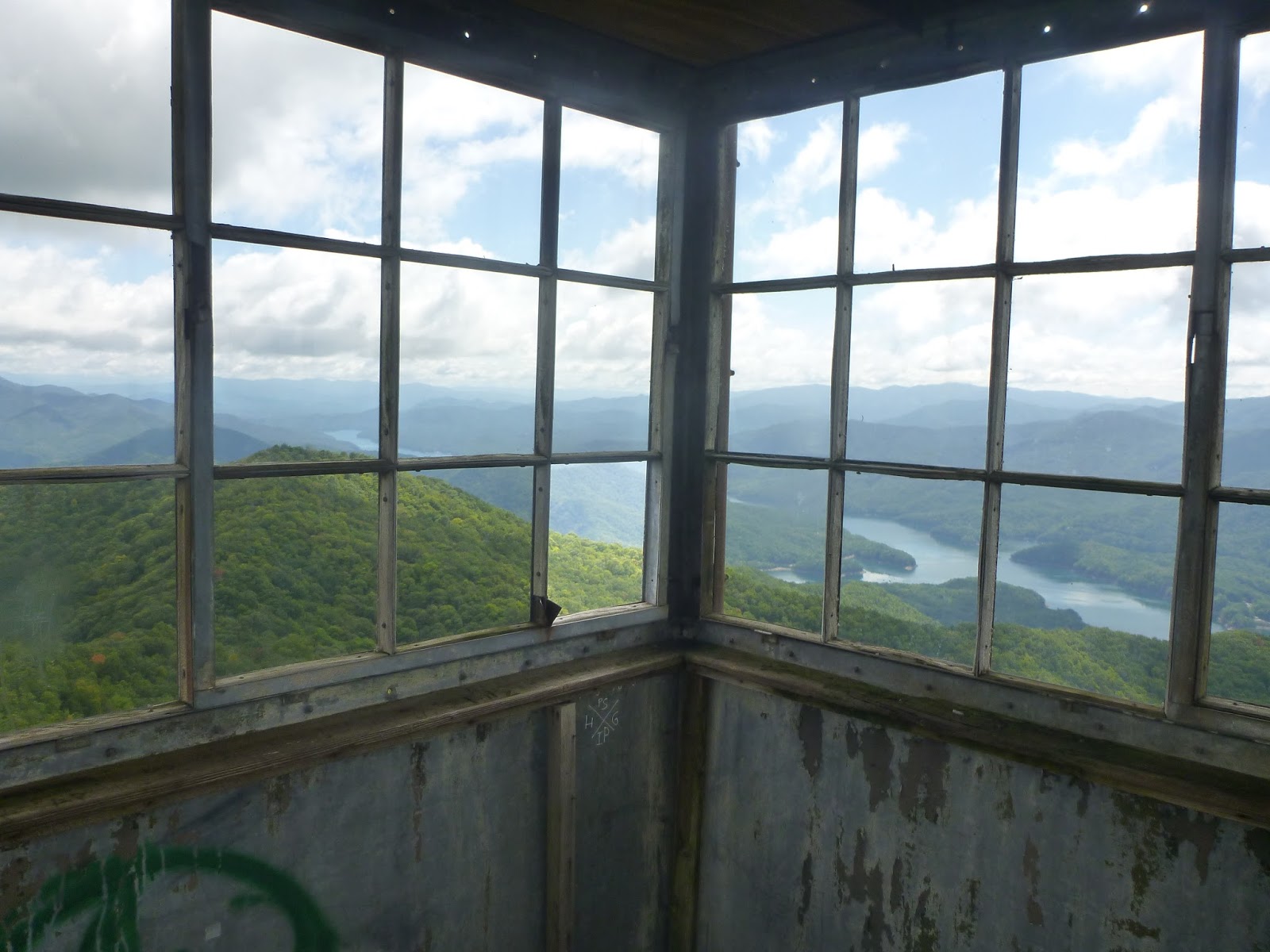
With about 4 miles to go, I took the short side trail (uphill, of course) to the Shuckstack fire tower. The tower supports only a small observation platform at the top, while the remains of the foundations of a firewarden's cabin are located below. The climb was a bit daunting, given my natural aversion to heights, but the view was excellent, and I could clearly see Fontana Lake and Fontana Dam, my ultimate destination.
It's an impressive view!


After a quick lunch break, it was time for the final push homewards, and I found myself jogging along the trail as it went down the mountain - an interesting sensation with a 30-pound  pack on your back.
Approaching Fontana Dam.

It was with real satisfaction that I strode the final yards across the top of Fontana Dam. 12 days, 175 miles, an average of 14 miles a day. Not Karl Meltzer speed, for sure, but pretty solid hiking over some big mountains and rough terrain. And best of all, nearly everything had gone according to plan. Yet I had one final surprise awaiting me.
Dead battery...
My trusty Subaru's battery was dead as a door nail. Fortunately the good people at the Fontana Dam Visitor's Center let me borrow their phone (no cell service at the dam), and I soon had AAA on the way. While waiting I talked to Samurai - the only true SOBO hiker I saw during the trip. Three months out from Maine, and with only 160 miles to go. Thin and ragged, but in good spirits.I offered a ride when my car got started, but he moved along before I was running again.
Samurai checks his trail guide
Eventually, I was on the way, with a new battery, a hot shower, and clean clothes. It was a great trip, and I'm looking forward to the future, when I can come back south to knock off the last miles between Fontana and Springer Mountain.
My white knight pickup truck.

Tuesday, September 20, 2016

Day 11 - Smoky Mountain rain

K9/18/16 - It's 8 PM - hiker midnight - and my journey has almost concluded. I have the spacious Russell Field Shelter all to myself, and overhead I can hear the intermittent patter of water dripping from the leaves onto the metal and plexiglas roof, a reminder of today's events. 

Today it rained. Except for some brief showers in the early morning hours of the fourth day, it's been dry throughout the trip. 

Hiking doesn't stop when it rains. You've simply got to gear up, put your head down, and plow ahead. As thruhikers say, "no rain, no Maine."
Morning scene - Silers Bald Shelter

Our threesome of last night grew by four after we'd turned in, as a group of four college students showed up under the guidance of their headlamps. They quickly settled in, and we all spent a fairly restful night.

By morning the wind had picked up and fog had rolled in. A sudden burst of wireless connectivity provided me with a weather forecast: a 90% chance of afternoon  thunderstorms, starting around 1-2 PM. With about 17 miles on the docket, that meant I needed to hustle.

The first 6 miles went smoothly, but then came a 6-mile stretch NOBOs had been warning about, with ascents up Thundee Miuntain and a stiff ascent over the exposed ridge of Rocky Top.

By the ascent of Thunder Mountain, the rain began in earnest, and on went my hat, rain jacket and pack cover. A steep and rocky trail made matters even more unpleasant. But as I hit the top of Thunder Miuntain, the rain eased, and I was able to traverse the exposed ridge lines with nothing worse than gusty winds and sheets of fog and mist whipping by. 

Eventually I descended to the Spence Field Shelter, the last reliable water source until Fontana Dam. I tanked up with a full four liters and made the decision to push on while the weather held.

The weather quickly turned back to sometimes heavy rain, but now I had the advantage of the best trail I'd seen in the Smokies so far - well graded, smooth, and sandy. I quickly knocked off the three miles to the next shelter and called it a day.
Gear drying time at Russell Field Shelter.

After a change of clothes and a hot mealI had time to get organized for the morning and laze away the afternoon in my sleeping bag, sipping hot tea and listening to football on my radio.

So ends another day on the trail. Tomorrow should be a fast downhill to Fontana, a shower, then the drive home to sleep in my own bed for the first time in almost two weeks. Can't wait!

Monday, September 19, 2016

Day 10 - Over the hump!

9/17/16 - Every journey or adventure will have its highs and lows. Geographical, physical, and emotional.
The observation tower at Clingman's Dome - the highest point on the AT, at 6600 feet.

Today I passed the geographical high point, while physically recovering well from yesterday's rocky 20 miler. And mentally I snapped out of a bit of a funk I'd gotten into over the last couple of days. While I've met many interesting and pleasant people, the lack of familiar faces each day was causing me to feel a bit lonely.

But if I'd lacked for human contact before, I didn't today.
Parking lot at Newfound Gap.

In the course of my first 3 miles I passed at least 75 day hikers, tromping up from Newfound Gap to see some of the sights, particularly Chatlies Bunion / think Humpback Rocks if you're from C-ville.

The crowds at the parking lot were a bit overwhelming, but I had a great opportunity to empty my trash (pack it in, pack it out), and actually use a toilet that flushed.

While at the parking lot I connected with a pack of three hikers heading north and exchanged trail notes. Despite our differences in age and number of tattoos or piercings we clearly identified as part of the same tribe.

Heading north, the crowds thinned, but I still had my pick of day hikers and groups passing by. Notably, I ran into a group from the Friends of the Smokies, a non-profit support group, accompanied by no less than the Asst. Superintendent of GSMNP. The group was supporting three of their members doing a northbound hike of the park. After chatting a while, they took my picture and promised to write about meeting me on their daily update. I promised the same!
Mementoes of my encounter.

I eventually reached Clingman's Dome - packed with tourists - and whiled away a while with Charlie, who was looking forward to a zero in Gatlinburg, watching football and drinking beer. I was jealous.
Charlie at Clingman's Dome.

I finally rolled into Silas Bald Shelter after a stress-free 15 miles, and met a local Tennessee father and son out for the weekend. After a career as an Army Ranger he'd come back home to settle down, and couldn't think of a place he'd rather be.
Father and son.

Gracious, dignified, and thoughtful, I think I'd cast Gary Cooper to play the fatherin the movie version of my trip. 

We relaxed by the fire with some sipping whiskey, and I went to bed pleasantly relaxed, turning over the words he'd spoken. "I'm glad you showed up Spike, you bring good karma with you." One of the nicest compliments I've ever received.